-
RAND MCNALLY ZANESVILLE, OHIO
Rand McNally and Company
Map (Rand McNally, Oct. 5, 2007)The members of the Munch Bunch enjoy various activities which illustrate pairs of words with opposite meanings.
-
Children's Atlas of the United States
Rand McNally and Company
Library Binding (Bt Bound, )None
-
Rand McNally fabMAP Santa Monica
Rand McNally
Map (Rand McNally, May 9, 2008)You will not want to put this waterproof map awayThe fabMAP puts it paper predecessors to shame. You'll never need to worry about getting the fold just right as this tear-proof, wrinkle-proof, microfiber waterproof map is virtually indestructible. Throw it in a pocket or a purse or keep it out to show off, the fabMAP lets you where you need to go in a new, fun fashion. These easy-to-read maps highlight points of interest, restaurants, hotels, and more. The fabMAP also can double as a cloth to clean eyewear, cell phones or laptop screens when on the road.Check out the most fun and convenient way to carry a map of the Santa Monica area around. A waterproof map without the folding headache: This napkin-sized fabric map fits easily into pockets, purses, suitcases and kids' handsTough - and soft Fabric Map: This tear-proof, wrinkle-proof, waterproof map can stand up to the elements when you're on the roadA fabric map with more: This waterproof map will get you where you need to be, but it can also be used as a cleaning cloth or protective sleeve for electronicsBig type, big fun: Even though this fabric map is little, the roads and points of interest are easy-to-read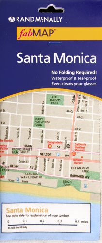
-
Rand Mcnally 2009 California Fabric Map
Rand McNally and Company
Map (Rand McNally, Feb. 2, 2009)None
-
Children's Millennium Atlas of the World
Rand McNally and Company
Hardcover (Rand McNally, Oct. 1, 1999)None R
R
-
Rand McNally Travels With Santa Sticker Book
Rand McNally and Company
Paperback (Rand McNally, Sept. 1, 1998)None
-
Vacation Fun Pack
Rand McNally and Company
Paperback (Rand McNally, April 1, 1998)Book by Rand McNally and Company
-
Rand McNally Primary Atlas Primary Atlas | Grades K-3
Rand McNally
Paperback (Rand McNally, June 24, 2016)Trust Rand McNally's Primary Atlas for the right amount and level of information for your student's first atlas. Our colorful, engaging atlas is ideal for students in pre-K through second grade and features bright, colorful maps and photos that bring early geography to life. Atlas features: Contains bright primary level maps of the world, the continents, and the United States Features beautiful real-life photos that illustrate the maps Includes introductory text and map questions that provide teaching strategies Early elementary atlas geared for students from pre-Kindergarten through second grade 16 pages, paperback, 8.5" x 11" R
R
-
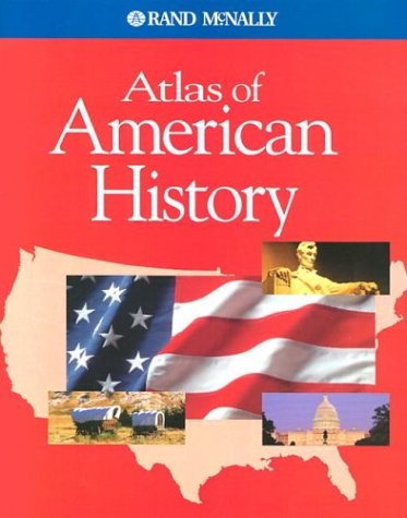
Atlas of American History
Rand McNally
Paperback (Rand McNally, Jan. 3, 2011)Rand McNally's Atlas of American History is a great intermediate history atlas geared for fifth- through 12th-grade students and beyond.Our colorful, engaging maps illustrate key events in U.S. history such as Westward Expansion in the early 1800s and much more. Atlas features: Organized by important periods of American history More than 80 colorful maps illustrating key events and eras, from routes of the first Americans through life in the United States today Chronologies, graphs, charts, and photos for each of eight historical periods Tables of facts about states Geared for students in fifth through 12th grades 80 pages (including detailed index), paperback, 8" x 10"Copyright Date: 2011
-
Atlas of World Geography
Rand McNally
Paperback (Rand McNally, Aug. 16, 2006)Rand McNally's Atlas of World Geography provides engaging and richly illustrated geographic information for secondary students from grades six through 12. Thematic maps, graphs and charts help present a more complete portrait of our physical and political world. Atlas features: 2006 copyright More than 65 highly detailed physical and political maps Thematic maps show plate tectonics, population, land use, climate, and more 20 pages of graphs, charts, and tables provide comparative information about physical, political, economic, and cultural features of the world Glossary and comprehensive index for making full use of maps Special continent sections highlight such themes as rain forest depletion, changing political boundaries in Europe, and the Ring of Fire in Asia 176 pages, paperback, 8.5" x 10 7/8"
-
Rand McNally Zip Code Finder 2000
Rand McNally
Paperback (Rand McNally, Nov. 1, 1999)Includes listings of more than 120,000 zip codes for cities, towns, and places, detailed zip code maps of thirteen major cities, and postal and private carrier information
-
Atlas of American History
Rand McNally
Paperback (Rand McNally, Sept. 1, 1998)The text in "Atlas of American History" presents a chronological overview of American history and summarizes key events. It provides cross curricular connections by listing literature that clarifies or expands historical understandings. It highlights people whose accomplishments reflect American ideals. The 'Did You Know?' feature on each section opening page provides an interesting sidelight to history.